The purpose of this page is to provide information for contributors to the Global Fossil Projects Tracker project.
Please see Discussion page for to-lists.
General resources
Country or region-specific resources
India
Formatting Tips
Videos
To embed a video in a page, you do not have to upload the video onto the SourceWatch servers. The video can still reside in YouTube but will be viewable to the reader of a SourceWatch page without leaving SourceWatch.
Here is the new formatting for embedded videos:
{{#ev:service|id|width|align|description|container}}
Example:
{{#ev:youtube|-dnL00TdmLY|400|center|Wikis in Plain English|frame}}
This produces the following:
Note that when you align with "center" the text will not wrap around the video. Use "left" or "right" when you want text to wrap. The number "400" represents the pixel width of the video. You can experiment with other numbers. A good rule of thumb for video widths is 210 for small, 300 for medium, 400 for normal, and 640 for big.
Click here for more information on using the embedded video extension.
Images
To add an image to a page, you need to be in editing mode. Then look on the far left side of the SourceWatch page for the command (located in the Toolbox) "Upload file."
After you upload a file into SourceWatch, it will be stored on the SourceWatch servers and can be embedded in any page.
Here is an example format:
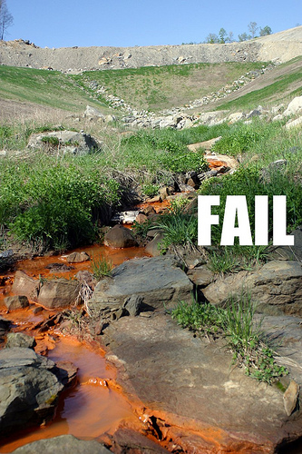
[[File:KYCoalWaste.jpg|thumb|center|upright=1.25|Photo courtesy of ilovemountains.org.]]

Photo courtesy of ilovemountains.org.
Note that if you replace "center" with "left" or "right," the photo will align on the left or the right and the text will wrap around the photo.
Tables
SourceWatch now allows sortable tables using the format shown below:
Here is an example:
{| class="wikitable sortable"
! width="200" | State !! width="200" | CoalSwarm Name !! width="200" | Sierra Name !! Size (MW) !! Status
|-
| Alaska||Hackhack||HackCentral||100||active
|-
| Ohio||MegaDirty||MegaBucks||200||active
|-
| West Virginia||Old Smokey||Byrd #1||400||canceled
|}
This creates the following table:
| State |
CoalSwarm Name |
Sierra Name |
Size (MW) |
Status
|
| Alaska |
Hackhack |
HackCentral |
100 |
active
|
| Ohio |
MegaDirty |
MegaBucks |
200 |
active
|
| West Virginia |
Old Smokey |
Byrd #1 |
400 |
canceled
|
Tip: The easiest way to make tables is to create the table in Excel. Then cut and paste the table into an Excel-to-MediaWiki converter such as http://excel2wiki.net/.
Maps
Using this:
{{#display_map: Richmond, Virginia}}
Results in this:
Loading map...
{"type":"ROADMAP","minzoom":false,"maxzoom":false,"types":["ROADMAP","SATELLITE","HYBRID","TERRAIN"],"mappingservice":"googlemaps3","width":"auto","height":"350px","centre":false,"title":"","label":"","icon":"","visitedicon":"","lines":[],"polygons":[],"circles":[],"rectangles":[],"wmsoverlay":false,"copycoords":false,"static":false,"zoom":14,"layers":[],"controls":["pan","zoom","type","scale","streetview","rotate"],"zoomstyle":"DEFAULT","typestyle":"DEFAULT","autoinfowindows":false,"resizable":false,"kmlrezoom":false,"poi":true,"markercluster":false,"clustergridsize":60,"clustermaxzoom":20,"clusterzoomonclick":true,"clusteraveragecenter":true,"clusterminsize":2,"imageoverlays":[],"kml":[],"gkml":[],"searchmarkers":"","enablefullscreen":false,"scrollwheelzoom":false,"locations":[{"text":"","title":"","link":"","lat":37.5385087,"lon":-77.43428,"icon":""}]}
Using this:
{{#display_point: Richmond, Virginia}}
Results in this:
Loading map...
{"type":"ROADMAP","minzoom":false,"maxzoom":false,"types":["ROADMAP","SATELLITE","HYBRID","TERRAIN"],"mappingservice":"googlemaps3","width":"auto","height":"350px","centre":false,"title":"","label":"","icon":"","visitedicon":"","lines":[],"polygons":[],"circles":[],"rectangles":[],"wmsoverlay":false,"copycoords":false,"static":false,"zoom":14,"layers":[],"controls":["pan","zoom","type","scale","streetview","rotate"],"zoomstyle":"DEFAULT","typestyle":"DEFAULT","autoinfowindows":false,"resizable":false,"kmlrezoom":false,"poi":true,"markercluster":false,"clustergridsize":60,"clustermaxzoom":20,"clusterzoomonclick":true,"clusteraveragecenter":true,"clusterminsize":2,"imageoverlays":[],"kml":[],"gkml":[],"searchmarkers":"","enablefullscreen":false,"scrollwheelzoom":false,"locations":[{"text":"","title":"","link":"","lat":37.5385087,"lon":-77.43428,"icon":""}]}
Using this:
{{#display_points:
39.489694, -79.639389~Albright Power Station~Click '''[[Albright Power Station|here]]''' for more information.;
38.135496, -81.278721~Alloy Steam Station~Click '''[[Alloy Steam Station|here]]''' for more information.;
38.476111, -81.82~Amos Plant~Click '''[[Amos Plant|here]]''' for more information.;
39.710611, -79.927806~Fort Martin Power Station~Click '''[[Fort Martin Power Station|here]]''' for more information.;
39.560277, -80.162893~Grant Town Power Plant~Click '''[[Grant Town Power Plant|here]]''' for more information.;
39.384389, -80.331889~Harrison Power Station~Click '''[[Harrison Power Station|here]]''' for more information.;
42.839239, -81.777984~John Amos Plant~Click '''[[John Amos Plant|here]]''' for more information.;
39.828889, -80.82~Kammer Plant~Click '''[[Kammer Plant|here]]''' for more information.;
38.206389, -81.423611~Kanawha River Plant~Click '''[[Kanawha River Plant|here]]''' for more information.;
39.828889, -80.82~Mitchell Plant~Click '''[[Mitchell Plant|here]]''' for more information.;
39.639998, -79.961394~Morgantown Energy Facility (WV)~Click '''[[Morgantown Energy Facility (WV)|here]]''' for more information.;
39.200556, -79.264167~Mount Storm Power Station~Click '''[[Mount Storm Power Station|here]]''' for more information.;
38.972806, -81.926889~Mountaineer Plant~Click '''[[Mountaineer Plant|here]]''' for more information.;
39.261602, -79.331152~North Branch Station~Click '''[[North Branch Station|here]]''' for more information.;
39.749389, -80.854778~PPG Natrium Plant~Click '''[[PPG Natrium Plant|here]]''' for more information.;
38.967194, -81.921389~Philip Sporn Power Plant~Click '''[[Philip Sporn Power Plant|here]]''' for more information.;
39.365889, -81.297306~Pleasants Power Station~Click '''[[Pleasants Power Station|here]]''' for more information.;
39.530611, -80.116694~Rivesville Power Station~Click '''[[Rivesville Power Station|here]]''' for more information.;
38.369908, -81.692615~Union Carbide South Charleston Power Plant~Click '''[[Union Carbide South Charleston Power Plant|here]]''' for more information.;
39.366889, -81.300306~Willow Island Power Station~Click '''[[Willow Island Power Station|here]]''' for more information
|width=700
|height=700
|zoom=6
|type=terrain
}}
Results in this:
Loading map...
{"type":"TERRAIN","minzoom":false,"maxzoom":false,"types":["ROADMAP","SATELLITE","HYBRID","TERRAIN"],"mappingservice":"googlemaps3","width":"700px","height":"700px","centre":false,"title":"","label":"","icon":"","visitedicon":"","lines":[],"polygons":[],"circles":[],"rectangles":[],"wmsoverlay":false,"copycoords":false,"static":false,"zoom":6,"layers":[],"controls":["pan","zoom","type","scale","streetview","rotate"],"zoomstyle":"DEFAULT","typestyle":"DEFAULT","autoinfowindows":false,"resizable":false,"kmlrezoom":false,"poi":true,"markercluster":false,"clustergridsize":60,"clustermaxzoom":20,"clusterzoomonclick":true,"clusteraveragecenter":true,"clusterminsize":2,"imageoverlays":[],"kml":[],"gkml":[],"searchmarkers":"","enablefullscreen":false,"scrollwheelzoom":false,"locations":[{"text":"\u003Cb\u003E\u003Cdiv class=\"mw-parser-output\"\u003E\u003Cp\u003EAlbright Power Station\n\u003C/p\u003E\u003C/div\u003E\u003C/b\u003E\u003Cdiv class=\"mw-parser-output\"\u003E\u003Cp\u003EClick \u003Cb\u003E\u003Ca href=\"/index.php?title=Albright_Power_Station\" title=\"Albright Power Station\"\u003Ehere\u003C/a\u003E\u003C/b\u003E for more information.\n\u003C/p\u003E\u003C/div\u003E","title":"Albright Power Station\n","link":"","lat":39.489694,"lon":-79.639389,"icon":""},{"text":"\u003Cb\u003E\u003Cdiv class=\"mw-parser-output\"\u003E\u003Cp\u003EAlloy Steam Station\n\u003C/p\u003E\u003C/div\u003E\u003C/b\u003E\u003Cdiv class=\"mw-parser-output\"\u003E\u003Cp\u003EClick \u003Cb\u003E\u003Ca href=\"/index.php?title=Alloy_Steam_Station\" title=\"Alloy Steam Station\"\u003Ehere\u003C/a\u003E\u003C/b\u003E for more information.\n\u003C/p\u003E\u003C/div\u003E","title":"Alloy Steam Station\n","link":"","lat":38.135496,"lon":-81.278721,"icon":""},{"text":"\u003Cb\u003E\u003Cdiv class=\"mw-parser-output\"\u003E\u003Cp\u003EAmos Plant\n\u003C/p\u003E\u003C/div\u003E\u003C/b\u003E\u003Cdiv class=\"mw-parser-output\"\u003E\u003Cp\u003EClick \u003Cb\u003E\u003Ca href=\"/index.php?title=Amos_Plant\" title=\"Amos Plant\"\u003Ehere\u003C/a\u003E\u003C/b\u003E for more information.\n\u003C/p\u003E\u003C/div\u003E","title":"Amos Plant\n","link":"","lat":38.476111,"lon":-81.82,"icon":""},{"text":"\u003Cb\u003E\u003Cdiv class=\"mw-parser-output\"\u003E\u003Cp\u003EFort Martin Power Station\n\u003C/p\u003E\u003C/div\u003E\u003C/b\u003E\u003Cdiv class=\"mw-parser-output\"\u003E\u003Cp\u003EClick \u003Cb\u003E\u003Ca href=\"/index.php?title=Fort_Martin_Power_Station\" title=\"Fort Martin Power Station\"\u003Ehere\u003C/a\u003E\u003C/b\u003E for more information.\n\u003C/p\u003E\u003C/div\u003E","title":"Fort Martin Power Station\n","link":"","lat":39.710611,"lon":-79.927806,"icon":""},{"text":"\u003Cb\u003E\u003Cdiv class=\"mw-parser-output\"\u003E\u003Cp\u003EGrant Town Power Plant\n\u003C/p\u003E\u003C/div\u003E\u003C/b\u003E\u003Cdiv class=\"mw-parser-output\"\u003E\u003Cp\u003EClick \u003Cb\u003E\u003Ca href=\"/index.php?title=Grant_Town_Power_Plant\" title=\"Grant Town Power Plant\"\u003Ehere\u003C/a\u003E\u003C/b\u003E for more information.\n\u003C/p\u003E\u003C/div\u003E","title":"Grant Town Power Plant\n","link":"","lat":39.560277,"lon":-80.162893,"icon":""},{"text":"\u003Cb\u003E\u003Cdiv class=\"mw-parser-output\"\u003E\u003Cp\u003EHarrison Power Station\n\u003C/p\u003E\u003C/div\u003E\u003C/b\u003E\u003Cdiv class=\"mw-parser-output\"\u003E\u003Cp\u003EClick \u003Cb\u003E\u003Ca href=\"/index.php?title=Harrison_Power_Station\" title=\"Harrison Power Station\"\u003Ehere\u003C/a\u003E\u003C/b\u003E for more information.\n\u003C/p\u003E\u003C/div\u003E","title":"Harrison Power Station\n","link":"","lat":39.384389,"lon":-80.331889,"icon":""},{"text":"\u003Cb\u003E\u003Cdiv class=\"mw-parser-output\"\u003E\u003Cp\u003EJohn Amos Plant\n\u003C/p\u003E\u003C/div\u003E\u003C/b\u003E\u003Cdiv class=\"mw-parser-output\"\u003E\u003Cp\u003EClick \u003Cb\u003E\u003Ca href=\"/index.php?title=John_Amos_Plant\" title=\"John Amos Plant\"\u003Ehere\u003C/a\u003E\u003C/b\u003E for more information.\n\u003C/p\u003E\u003C/div\u003E","title":"John Amos Plant\n","link":"","lat":42.839239,"lon":-81.777984,"icon":""},{"text":"\u003Cb\u003E\u003Cdiv class=\"mw-parser-output\"\u003E\u003Cp\u003EKammer Plant\n\u003C/p\u003E\u003C/div\u003E\u003C/b\u003E\u003Cdiv class=\"mw-parser-output\"\u003E\u003Cp\u003EClick \u003Cb\u003E\u003Ca href=\"/index.php?title=Kammer_Plant\" title=\"Kammer Plant\"\u003Ehere\u003C/a\u003E\u003C/b\u003E for more information.\n\u003C/p\u003E\u003C/div\u003E","title":"Kammer Plant\n","link":"","lat":39.828889,"lon":-80.82,"icon":""},{"text":"\u003Cb\u003E\u003Cdiv class=\"mw-parser-output\"\u003E\u003Cp\u003EKanawha River Plant\n\u003C/p\u003E\u003C/div\u003E\u003C/b\u003E\u003Cdiv class=\"mw-parser-output\"\u003E\u003Cp\u003EClick \u003Cb\u003E\u003Ca href=\"/index.php?title=Kanawha_River_Plant\" title=\"Kanawha River Plant\"\u003Ehere\u003C/a\u003E\u003C/b\u003E for more information.\n\u003C/p\u003E\u003C/div\u003E","title":"Kanawha River Plant\n","link":"","lat":38.206389,"lon":-81.423611,"icon":""},{"text":"\u003Cb\u003E\u003Cdiv class=\"mw-parser-output\"\u003E\u003Cp\u003EMitchell Plant\n\u003C/p\u003E\u003C/div\u003E\u003C/b\u003E\u003Cdiv class=\"mw-parser-output\"\u003E\u003Cp\u003EClick \u003Cb\u003E\u003Ca href=\"/index.php?title=Mitchell_Plant\" title=\"Mitchell Plant\"\u003Ehere\u003C/a\u003E\u003C/b\u003E for more information.\n\u003C/p\u003E\u003C/div\u003E","title":"Mitchell Plant\n","link":"","lat":39.828889,"lon":-80.82,"icon":""},{"text":"\u003Cb\u003E\u003Cdiv class=\"mw-parser-output\"\u003E\u003Cp\u003EMorgantown Energy Facility (WV)\n\u003C/p\u003E\u003C/div\u003E\u003C/b\u003E\u003Cdiv class=\"mw-parser-output\"\u003E\u003Cp\u003EClick \u003Cb\u003E\u003Ca href=\"/index.php?title=Morgantown_Energy_Facility_(WV)\" title=\"Morgantown Energy Facility (WV)\"\u003Ehere\u003C/a\u003E\u003C/b\u003E for more information.\n\u003C/p\u003E\u003C/div\u003E","title":"Morgantown Energy Facility (WV)\n","link":"","lat":39.639998,"lon":-79.961394,"icon":""},{"text":"\u003Cb\u003E\u003Cdiv class=\"mw-parser-output\"\u003E\u003Cp\u003EMount Storm Power Station\n\u003C/p\u003E\u003C/div\u003E\u003C/b\u003E\u003Cdiv class=\"mw-parser-output\"\u003E\u003Cp\u003EClick \u003Cb\u003E\u003Ca href=\"/index.php?title=Mount_Storm_Power_Station\" title=\"Mount Storm Power Station\"\u003Ehere\u003C/a\u003E\u003C/b\u003E for more information.\n\u003C/p\u003E\u003C/div\u003E","title":"Mount Storm Power Station\n","link":"","lat":39.200556,"lon":-79.264167,"icon":""},{"text":"\u003Cb\u003E\u003Cdiv class=\"mw-parser-output\"\u003E\u003Cp\u003EMountaineer Plant\n\u003C/p\u003E\u003C/div\u003E\u003C/b\u003E\u003Cdiv class=\"mw-parser-output\"\u003E\u003Cp\u003EClick \u003Cb\u003E\u003Ca href=\"/index.php?title=Mountaineer_Plant\" title=\"Mountaineer Plant\"\u003Ehere\u003C/a\u003E\u003C/b\u003E for more information.\n\u003C/p\u003E\u003C/div\u003E","title":"Mountaineer Plant\n","link":"","lat":38.972806,"lon":-81.926889,"icon":""},{"text":"\u003Cb\u003E\u003Cdiv class=\"mw-parser-output\"\u003E\u003Cp\u003ENorth Branch Station\n\u003C/p\u003E\u003C/div\u003E\u003C/b\u003E\u003Cdiv class=\"mw-parser-output\"\u003E\u003Cp\u003EClick \u003Cb\u003E\u003Ca href=\"/index.php?title=North_Branch_Station\" title=\"North Branch Station\"\u003Ehere\u003C/a\u003E\u003C/b\u003E for more information.\n\u003C/p\u003E\u003C/div\u003E","title":"North Branch Station\n","link":"","lat":39.261602,"lon":-79.331152,"icon":""},{"text":"\u003Cb\u003E\u003Cdiv class=\"mw-parser-output\"\u003E\u003Cp\u003EPPG Natrium Plant\n\u003C/p\u003E\u003C/div\u003E\u003C/b\u003E\u003Cdiv class=\"mw-parser-output\"\u003E\u003Cp\u003EClick \u003Cb\u003E\u003Ca href=\"/index.php?title=PPG_Natrium_Plant\" title=\"PPG Natrium Plant\"\u003Ehere\u003C/a\u003E\u003C/b\u003E for more information.\n\u003C/p\u003E\u003C/div\u003E","title":"PPG Natrium Plant\n","link":"","lat":39.749389,"lon":-80.854778,"icon":""},{"text":"\u003Cb\u003E\u003Cdiv class=\"mw-parser-output\"\u003E\u003Cp\u003EPhilip Sporn Power Plant\n\u003C/p\u003E\u003C/div\u003E\u003C/b\u003E\u003Cdiv class=\"mw-parser-output\"\u003E\u003Cp\u003EClick \u003Cb\u003E\u003Ca href=\"/index.php?title=Philip_Sporn_Power_Plant\" title=\"Philip Sporn Power Plant\"\u003Ehere\u003C/a\u003E\u003C/b\u003E for more information.\n\u003C/p\u003E\u003C/div\u003E","title":"Philip Sporn Power Plant\n","link":"","lat":38.967194,"lon":-81.921389,"icon":""},{"text":"\u003Cb\u003E\u003Cdiv class=\"mw-parser-output\"\u003E\u003Cp\u003EPleasants Power Station\n\u003C/p\u003E\u003C/div\u003E\u003C/b\u003E\u003Cdiv class=\"mw-parser-output\"\u003E\u003Cp\u003EClick \u003Cb\u003E\u003Ca href=\"/index.php?title=Pleasants_Power_Station\" title=\"Pleasants Power Station\"\u003Ehere\u003C/a\u003E\u003C/b\u003E for more information.\n\u003C/p\u003E\u003C/div\u003E","title":"Pleasants Power Station\n","link":"","lat":39.365889,"lon":-81.297306,"icon":""},{"text":"\u003Cb\u003E\u003Cdiv class=\"mw-parser-output\"\u003E\u003Cp\u003ERivesville Power Station\n\u003C/p\u003E\u003C/div\u003E\u003C/b\u003E\u003Cdiv class=\"mw-parser-output\"\u003E\u003Cp\u003EClick \u003Cb\u003E\u003Ca href=\"/index.php?title=Rivesville_Power_Station\" title=\"Rivesville Power Station\"\u003Ehere\u003C/a\u003E\u003C/b\u003E for more information.\n\u003C/p\u003E\u003C/div\u003E","title":"Rivesville Power Station\n","link":"","lat":39.530611,"lon":-80.116694,"icon":""},{"text":"\u003Cb\u003E\u003Cdiv class=\"mw-parser-output\"\u003E\u003Cp\u003EUnion Carbide South Charleston Power Plant\n\u003C/p\u003E\u003C/div\u003E\u003C/b\u003E\u003Cdiv class=\"mw-parser-output\"\u003E\u003Cp\u003EClick \u003Cb\u003E\u003Ca href=\"/index.php?title=Union_Carbide_South_Charleston_Power_Plant\" title=\"Union Carbide South Charleston Power Plant\"\u003Ehere\u003C/a\u003E\u003C/b\u003E for more information.\n\u003C/p\u003E\u003C/div\u003E","title":"Union Carbide South Charleston Power Plant\n","link":"","lat":38.369908,"lon":-81.692615,"icon":""},{"text":"\u003Cb\u003E\u003Cdiv class=\"mw-parser-output\"\u003E\u003Cp\u003EWillow Island Power Station\n\u003C/p\u003E\u003C/div\u003E\u003C/b\u003E\u003Cdiv class=\"mw-parser-output\"\u003E\u003Cp\u003EClick \u003Cb\u003E\u003Ca href=\"/index.php?title=Willow_Island_Power_Station\" title=\"Willow Island Power Station\"\u003Ehere\u003C/a\u003E\u003C/b\u003E for more information\n\u003C/p\u003E\u003C/div\u003E","title":"Willow Island Power Station\n","link":"","lat":39.366889,"lon":-81.300306,"icon":""}]}
Using this:
{{#display_map:
41.494703, -88.123534
|width=360
|height=210
|type=satellite
|zoom=14
}}
Results in this:
Loading map...
{"type":"SATELLITE","minzoom":false,"maxzoom":false,"types":["ROADMAP","SATELLITE","HYBRID","TERRAIN"],"mappingservice":"googlemaps3","width":"360px","height":"210px","centre":false,"title":"","label":"","icon":"","visitedicon":"","lines":[],"polygons":[],"circles":[],"rectangles":[],"wmsoverlay":false,"copycoords":false,"static":false,"zoom":14,"layers":[],"controls":["pan","zoom","type","scale","streetview","rotate"],"zoomstyle":"DEFAULT","typestyle":"DEFAULT","autoinfowindows":false,"resizable":false,"kmlrezoom":false,"poi":true,"markercluster":false,"clustergridsize":60,"clustermaxzoom":20,"clusterzoomonclick":true,"clusteraveragecenter":true,"clusterminsize":2,"imageoverlays":[],"kml":[],"gkml":[],"searchmarkers":"","enablefullscreen":false,"scrollwheelzoom":false,"locations":[{"text":"","title":"","link":"","lat":41.494703,"lon":-88.123534,"icon":""}]}
Using this:
{{#display_point:
41.494703, -88.123534~Joliet 29 Generating Station~Joliet, Illinois
|width=360
|height=210
|type=terrain
|zoom=14
}}
Results in this:
Loading map...
{"type":"TERRAIN","minzoom":false,"maxzoom":false,"types":["ROADMAP","SATELLITE","HYBRID","TERRAIN"],"mappingservice":"googlemaps3","width":"360px","height":"210px","centre":false,"title":"","label":"","icon":"","visitedicon":"","lines":[],"polygons":[],"circles":[],"rectangles":[],"wmsoverlay":false,"copycoords":false,"static":false,"zoom":14,"layers":[],"controls":["pan","zoom","type","scale","streetview","rotate"],"zoomstyle":"DEFAULT","typestyle":"DEFAULT","autoinfowindows":false,"resizable":false,"kmlrezoom":false,"poi":true,"markercluster":false,"clustergridsize":60,"clustermaxzoom":20,"clusterzoomonclick":true,"clusteraveragecenter":true,"clusterminsize":2,"imageoverlays":[],"kml":[],"gkml":[],"searchmarkers":"","enablefullscreen":false,"scrollwheelzoom":false,"locations":[{"text":"\u003Cb\u003E\u003Cdiv class=\"mw-parser-output\"\u003E\u003Cp\u003EJoliet 29 Generating Station\n\u003C/p\u003E\u003C/div\u003E\u003C/b\u003E\u003Cdiv class=\"mw-parser-output\"\u003E\u003Cp\u003EJoliet, Illinois\n\u003C/p\u003E\u003C/div\u003E","title":"Joliet 29 Generating Station\n","link":"","lat":41.494703,"lon":-88.123534,"icon":""}]}
