File:Nov 2010 earthquake epicenter.jpg
Jump to navigation
Jump to search
Size of this preview: 536 × 599 pixels. Other resolutions: 215 × 240 pixels | 612 × 684 pixels.
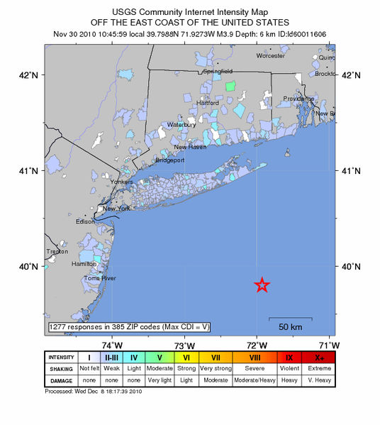
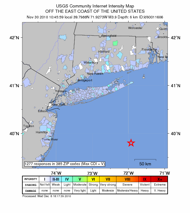
Original file (612 × 684 pixels, file size: 216 KB, MIME type: image/jpeg)
USGS Map of November 30, 2010 earthquake epicenter off New Jersey/New York coast. Source: United States Geological Survey
File history
Click on a date/time to view the file as it appeared at that time.
| Date/Time | Thumbnail | Dimensions | User | Comment | |
|---|---|---|---|---|---|
| current | 23:27, 30 December 2010 | | 612 × 684 (216 KB) | Colleenelizabeth (talk | contribs) | USGS Map of November 30, 2010 earthquake epicenter off New Jersey/New York coast. Source: [http://earthquake.usgs.gov/earthquakes/dyfi/events/ld/60011606/us/index.html United States Geological Survey] |
- You cannot overwrite this file.
File usage
There are no pages that use this file.